regional Scale - composite-map
Composite Regional Analysis
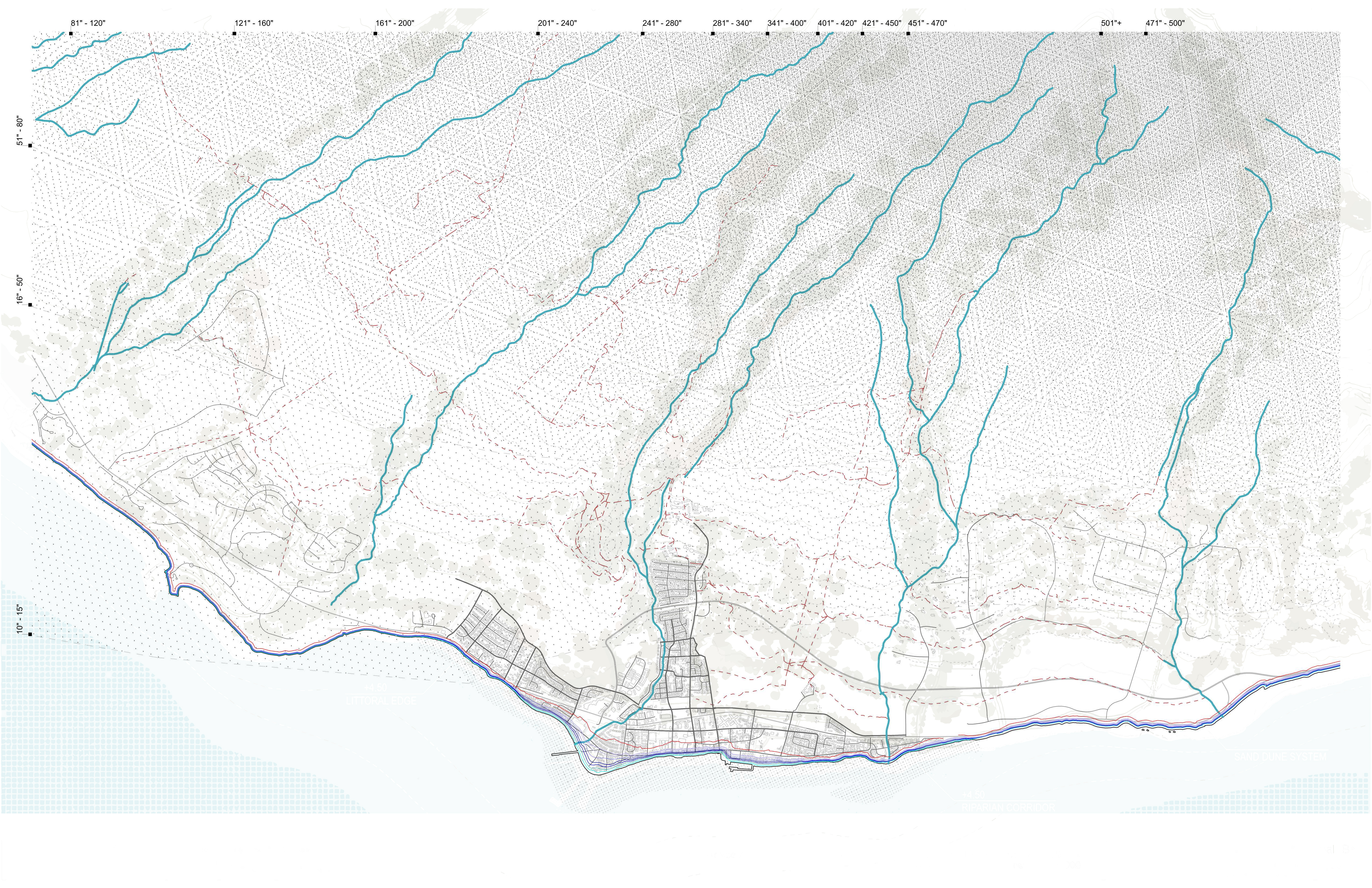
Combined systems identifying developable edges and constraint zones. Overlays rainfall, streams, sea level rise projections, and topographic data to define where development is feasible and where natural systems must be preserved.