Rebuilding Lahaina
After the 2023 wildfire, Lahaina needs a path forward. This project proposes a recovery plan addressing water systems, housing, infrastructure, and community resilience — built from research, data, and the land itself.
A graduate thesis by Akhil Singh — Tulane School of Architecture, M.Arch 2025
Live Updates
Maui & Lahaina news via Google News
What you'll find here
This site is a public resource. Everything from the research, maps, and analysis to the recovery plan itself is here for anyone to explore — whether you're a resident, a planner, a researcher, or just someone who cares about Lahaina's future.
Read the Full Thesis
Follow the complete story — from what happened, to what the data shows, to what could be built.
Browse by Topic
Jump straight to what matters to you — water, housing, fire prevention, cultural heritage, and more.
View Maps & Drawings
See the analysis and proposals through detailed maps, plans, sections, and diagrams.
About this project
On August 8, 2023, wind-driven wildfires killed 102 people in Lahaina and destroyed more than 2,200 structures — the deadliest American wildfire in over a century. The proposed framework organizes recovery around three interconnected systems: water-sensitive infrastructure that restores the mauka-to-makai hydrological continuity severed by plantation-era development; a reconfigured mobility network centered on a new inland boulevard replacing the failed coastal evacuation corridor; and a network of community hubs anchoring re-densified housing within walkable, resilient neighborhoods.
Featured Drawings
Hawaiian Ali'i Houses - Various Types
Illustrations of various Hawaiian ali'i house types including Princess Ruth's house in Kona, drying sheds, stone heiau with ceremonial tower, and grass house with plaited ridges, from the 1969 Lahaina Architectural Style Book, Sheet B3
Sections - Before Fire
Cross-sections showing Lahaina's spatial condition before the 2023 wildfire
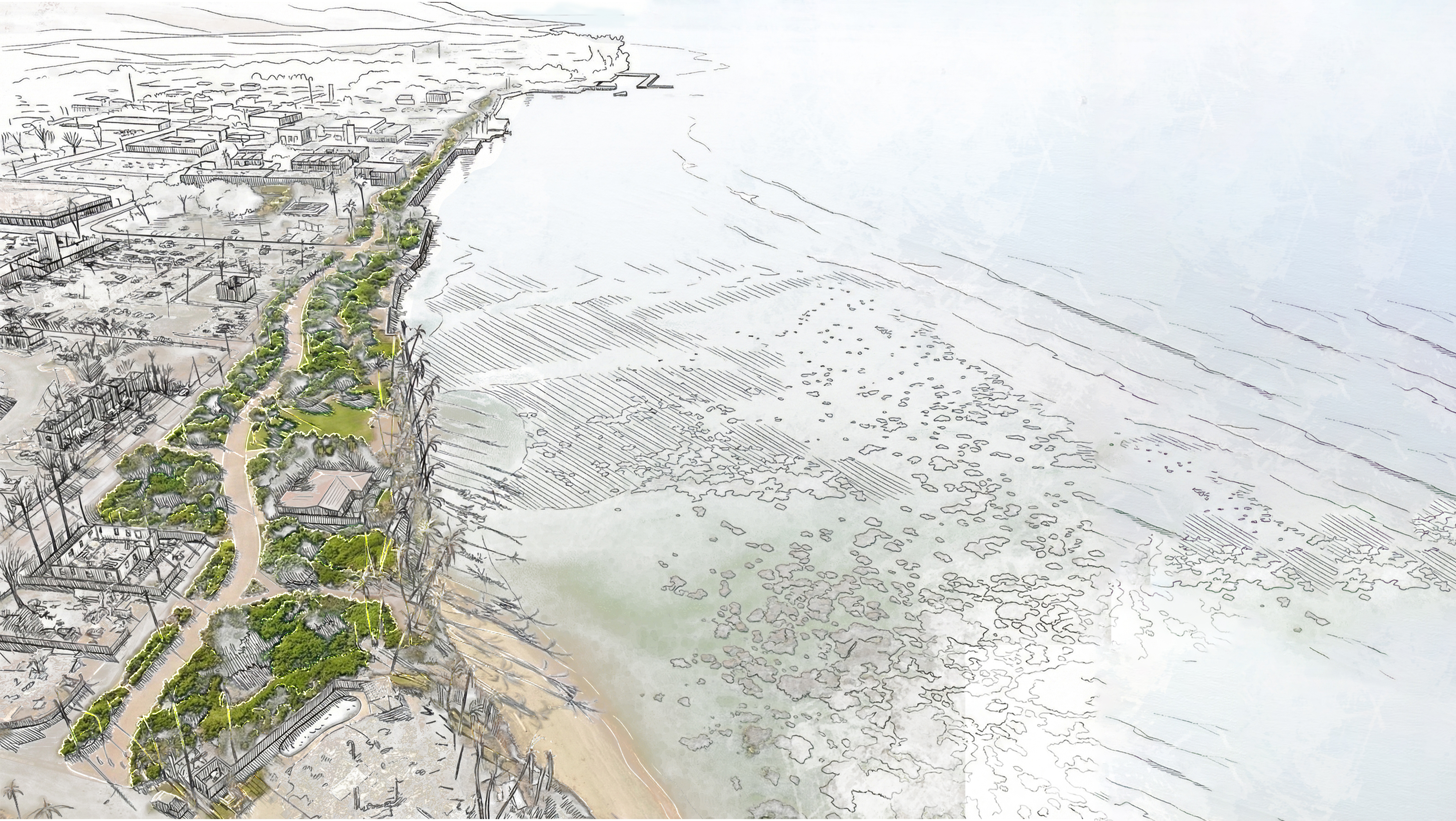
Coastal Buffer Map
Plan showing the coastal buffer zone defined by sea level rise projections and the inland retreat boundary
Explore the Data
Explore 16 GIS layers covering water systems, infrastructure, transportation, hazards, and community resources across the Lahaina recovery area.
Lahaina Map Explorer
16 data layers from Hawaii State GIS: streams, ditches, aquifers, watersheds, SLR exposure, roads, bikeways, schools, and more
Lahaina's Story
From the traditional ahupua'a system to the 2023 fire and beyond.
View Full Timeline