plan
Coastal Buffer Map
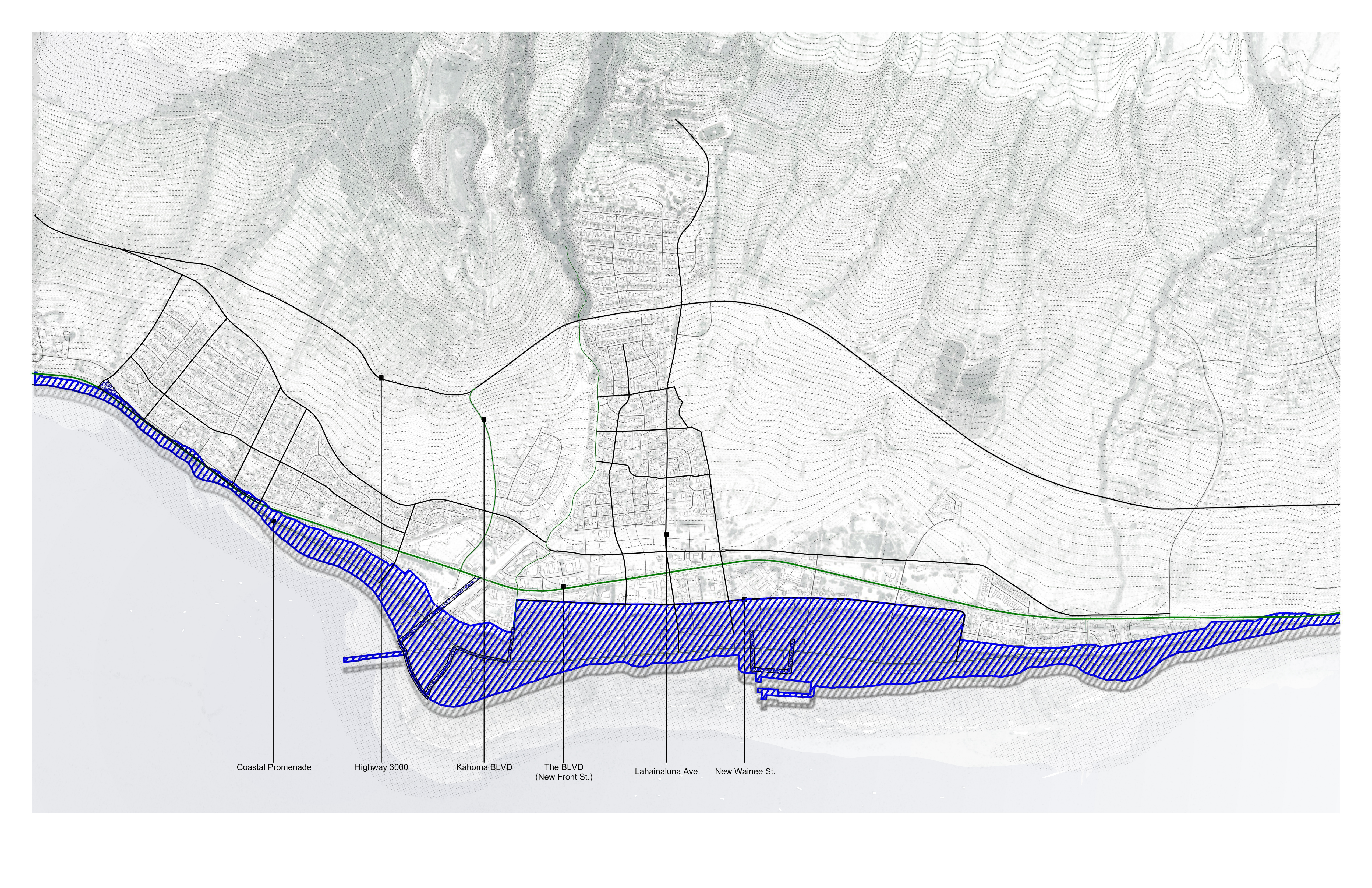
The coastal buffer defined by sea level rise analysis. Wainee Street marks the inland boundary, with the zone transitioning from built environment to public coastal park.
Dimensions
The buffer extends 150–300 feet from current mean high water, defined by the SLR-XA boundary and the 0–20-foot contour. Under NOAA intermediate projections, 3.2 feet of sea level rise is expected by 2100 — the design accommodates this within the retreat zone.
Key rules
- No new permanent residential or commercial construction inside the SLR-XA. Existing residents may rebuild, but new density is directed to the redevelopment core.
- Existing structures must be elevated to base flood elevation plus three feet, adapted for periodic flooding, or relocated inland.
- A 1.8-mile continuous pedestrian promenade replaces vehicle-dominated Front Street, connecting Mala Wharf to Puamana without interruption. No private development may block, gate, or narrow this corridor.
