concept-diagram
Buffer Framework - Mauka to Makai
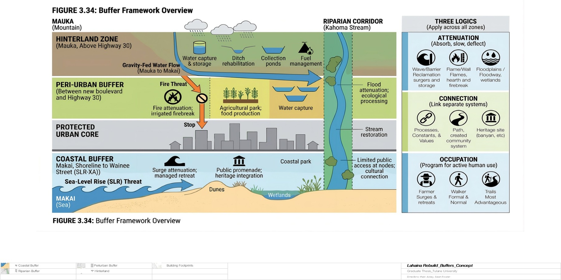
The organizing concept of the recovery plan shown as a mauka-to-makai transect, with four buffer zones surrounding a protected urban core.
The four buffers
- Coastal buffer — Managed retreat, dune restoration, coastal park, and a pedestrian promenade replace the vulnerable shoreline edge.
- Peri-urban buffer — An agricultural park and fire break between the town and the wildfire-prone hillside, combining food production with fire attenuation.
- Riparian corridor — Stream and ditch restoration reconnects the water system from mountain to coast, providing flood attenuation and ecological habitat.
- Hinterland catchment — Cloud forest reforestation and high-elevation storage capture rainfall before it reaches the town, feeding the water network by gravity.
Three logics
Each buffer operates through attenuation (slowing environmental forces), connection (linking systems across scale), and occupation (programming spaces for daily community use alongside their protective function).