Existing Water Systems
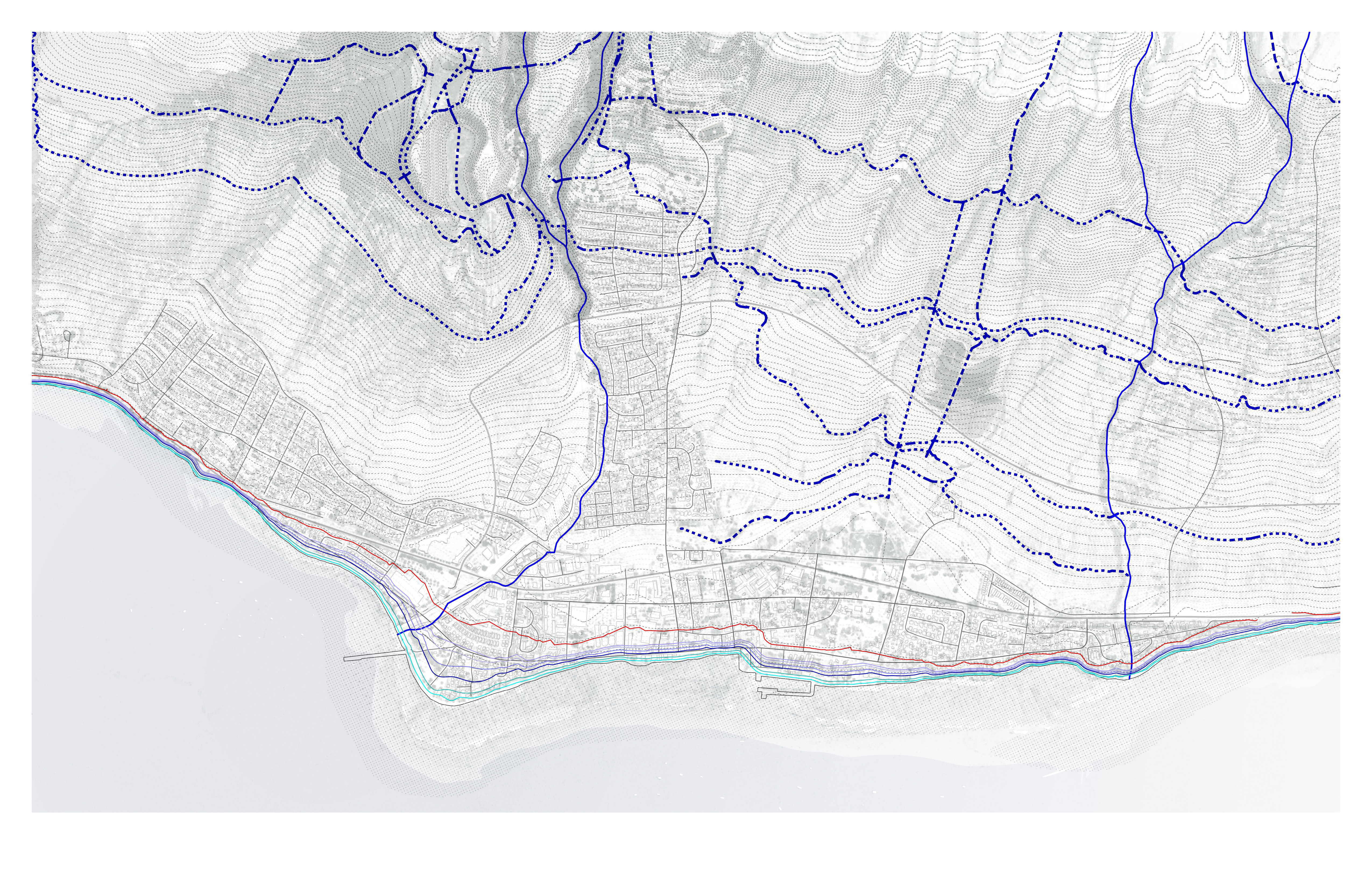
Town-scale mapping of Lahaina’s existing water systems, including streams, ditches, collection pools, retention areas, and infrastructure corridors.
The deficit
Reliable water supply capacity stands at approximately 4.26 MGD (million gallons per day) while demand runs at 6.04 MGD — a 41.8% deficit. The Stage 2 Water Shortage Declaration (effective September 2025) means new water meters for rebuilt homes cannot be issued. Displaced residents cannot return not because their lots are uncleared, but because there is no water to serve new construction.
What the map shows
The blue lines trace the network of natural streams and engineered ditches that once moved water from the West Maui mountains through the plantation landscape to the coast. Solid lines mark active or partially functioning channels; dashed lines show degraded or disconnected segments. Pioneer Mill’s approximately 50 miles of ditches, flumes, and reservoirs captured mountain rainfall for sugarcane. When the mill closed in 1999, maintenance ceased and the infrastructure deteriorated. WSP’s 2024 survey documented 11 water-control structures at 1,000–3,000 feet elevation that could be rehabilitated.
West Maui receives enormous rainfall at elevation — exceeding 80 inches per year above 1,000 feet — but virtually none of it reaches the town. The map reveals how much of the historical water logic has been severed, leaving the town dependent on a single overstressed aquifer.
