base-map
Lahaina Base Map
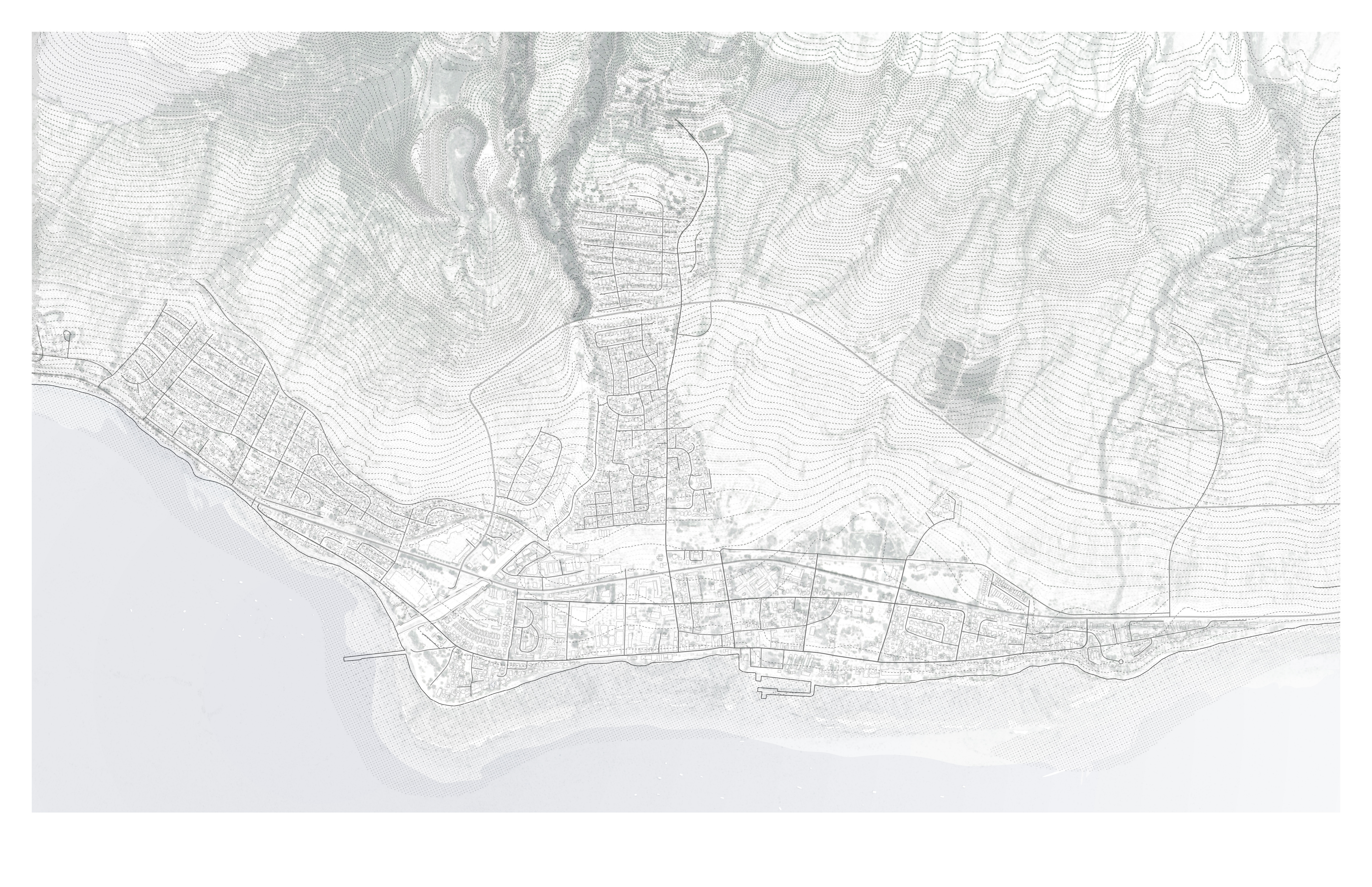
The base Lahaina drawing used to structure the town-scale analysis. It establishes the topography, road network, runoff patterns, and building footprints that subsequent system overlays build on.
How to read the base map
The map uses 1-foot contour intervals derived from LiDAR data to reveal the terrain the town sits on. Lahaina occupies a narrow coastal plain backed by steep, fire-prone hillside. The topography explains the town’s vulnerability: a single-spine road system along the coast, limited perpendicular escape routes, water flowing rapidly from mountain to ocean with minimal interception, and an exposed urban edge where dry grassland meets built fabric. Every analytical overlay in the thesis — fire, water, mobility, density — builds on this base.