plan
Water Capture Network
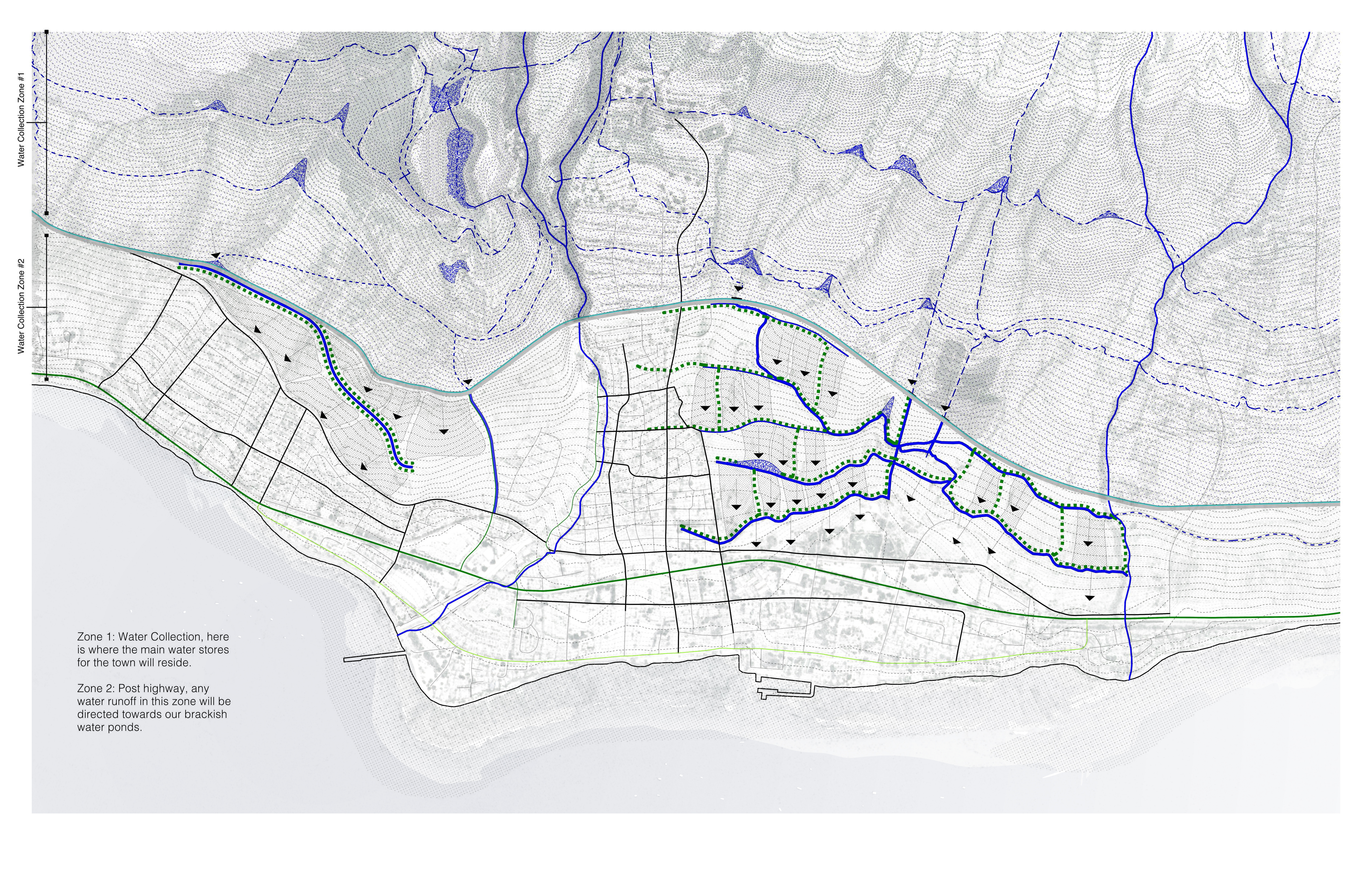
Proposed water capture network showing how collection zones, channels, and directional flows move water from the hinterland into retention and distribution systems serving the town.
The problem it solves
Current demand exceeds reliable supply by 41.8% (6.04 MGD vs. 4.26 MGD). The distributed capture strategy does not replace the aquifer but reduces dependence on it, targeting 30% of non-potable demand met through captured rainfall and diverted stream flow.
Five zones
- Hinterland collection (above 1,000 ft): Rehabilitated ditch intakes and gravity-fed reservoirs capture rainfall exceeding 80 in/year. Gravity distribution eliminates pump dependence — critical because pump-dependent systems failed when power was cut during the 2023 fire.
- Collection ponds (topographic pockets): Retention basins sized at 0.5 acres programmable surface per 10 acres drainage area; dual-use as public space during dry conditions and emergency fire-suppression reserves.
- Interception corridor (Highway 30): Swales, bioretention cells, and subsurface storage intercept runoff before it crosses impervious road surfaces and is lost to the ocean.
- Peri-urban distribution (200–1,000 ft): Retention basins sized for 25-year storm events feed irrigated agriculture that maintains the firebreak function year-round.
- Building-scale capture (within the town): Module roofs direct rainfall into gutters, filtered through volcanic gravel into sub-grade tanks; rooftop cisterns supplement non-potable demand.
No single zone solves the crisis. Resilience comes from cumulative attenuation across all five layers.